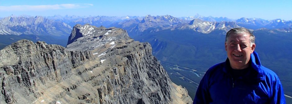
Bald Eagle Peak Canmore Scramble June 2009 No Bushwack Route

Bald Eagle Peak Crux, Canmore, Canadian Rockies


p6280689

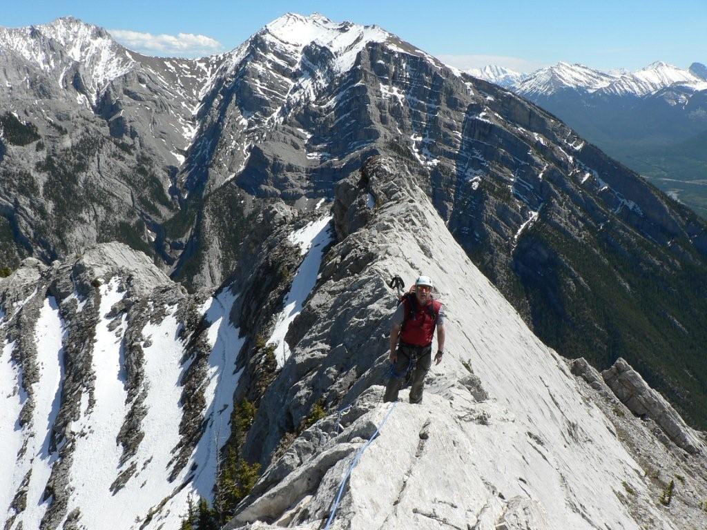
Slab ramp crux on side of Bald Eagle Peak, Canmore, Bow Valley

About 1200 m of elevation gain.

More Pictures are here 

https://billkerr.zenfolio.com/p87047268

June 2009, I do not know if there is anyone out there who has not done this yet but bushwacking is no longer necessary. I had put off doing this because of all the reports of bad thrashing and compass readings, etc. Larger version of map in pics. Note I walked about 1.5 km along Meander until it turns right and drop off left side on game trails. Best access now is park at Harvey Heights Community center and take Tibits Quarry trail or Palliser Parking Lot – Meander – left on Ridge Traverse right on Tibbitt’s to Montane high point and left onto switchbacks which is Bald Eagle route 
squaws-tit-approach-trails1

I decide to do Bald Eagle Peak solo after my hiker friend called in the morning to cancel with some lame excuse about a leaky water heater and potentially flooded basement. I decided to switch objectives to the peak now know as Bald Eagle Peak since by now there must be trails and solo since no time to find anyone and everyone I know has done it anyway.
I took my GPS and was determined to do minimal bushwacking. Parked at the dayuse lot just East of the dry drainage that crosses the road on the East side of Harvie Heights. Map sign

Took the Meander trail for about 1.5 km to a point where I thought I should bushwack(after it turns right) and there was a game trail going off the left side exactly where I wanted to go(drops down 10 or 20 feet). Followed it down and across a drainage and small stream(could be wet/messy in spring) and then up slopes through mostly open forest until I hit the Montaine traverse trail. I went up right on Montaine until near its highpoint(note jog on map) and there was a very good trail leading off the left and up the ridge through the trees. This had 2-3 logs marking it(no rock cairn? but hear one has been added) and it lead all the way up the ridge to the rock. Above tree line it breaks into many scree variations(down tracks) but there are always switchbacked up trails on either side. Once on the ridge stuck close to the left edge on the rock ridge within 10 – 20 ft of the edge all the way to get the best scrambling and avoid the scree bypasses. There is one spot of slabby 5.3 that was probably avoidable but fun. Slab to the left side of summit block was dry, clean and grippy.

After come off rock ridge on the way down, avoid going too far skiers left on the scree trails as you will miss the trail in the trees( stay out of the drainage to skiers far left as it has various slabs to downclimb and there have been multiple rescues!!). 

Overall a quick fun trip.

Note the fastest best approach trail route would be to park at the Harvie Heights community center and take the Tibits Quarry trail to the Montaine trail. Leave Montaine trail near highpoint where a  good trail leads to the ridge. This would be less direct and slightly longer but all built trail. Parking may also be scarce.
Posted in alpine climb, scramble, trip | Tagged , , , , , , , | 1 Comment

ESE Ridge of Lady MacDonald 5.5 (aka SE Ridge)

lady20mac20-20se20ridge20031p5290506

Rock climb with Kevin Papke – 1300 m –  up to 5.5 – lots of knife edge ridge.

Eight hours up – 2 hours down.

May 29, 2009.  Parked at the Cougar Canyon park lot. This time of year, you have to cross the stream 5-6 times on various wet slippery rock crossings as the trail goes from side to side. Expect to get toes wet. After about 45 min to 1 hour depending on stream crossings, see a cairn on the left side just before a big bend in the river.  A faint trail starts up the right side of the crest of a lightly treed ridge.  Lots of ticks as this is prime sheep habitat.


We went along close to the crest (left side) of ridge on various trails for about 1 hour for about 500 m. until hit first rock band – 30 m high wall.  Checked down and left but couldn’t find easy spot. Apparently the easy scramble route is farther uphill to the right.   We went up a 5.4 groove for 30 m and then scrambled some slabs and trees for another 50 m. 


Put rope away if used it as it is another 1 hour as go up scree, small rock bands and treed ridge until hit second rock band which is 50m+ wall.  Lots of cairns and we went down and left to the find the 5.5 layback crack beside a big tree.  Need a left hand underhand move to go up this and some people rate it at 5.4.  Good protection placements in crack. Hit bolted belay in 30 m(hangers removed as of Aug/2011- see comments). Top of ridge in another 20 m.


Now on rock ridge, go over exposed knife edge sections, some bolts(hangers removed as of aug/2011) and over one 5.2 tower.  Put away the rope again for 20 -30 min as hike down scree and back up along broad ridge as it turns left. Scramble around some towers and up to a large tower/rock band that blocks the ridge. The trails leads right for 100 m along a 10 m wide ledge at the base of the band and then up easy rock for 15m to another ledge at the base of second rock band. Traverse back left to the top of the tower and then up onto upper rock band/rock ridge.  This would be quite easy if dry but it was deep snow when we did it and not pleasant as we wallowed and were at risk of avalanche. A group behind climbed a 5.5? groove to the right of the tower but it was wet and we had our boots on so we went with the snow. Some groups rate this as 5.4 when dry and it would be much faster and safer than going around on the ledges.


The upper rock ridge has sections of knife edge and rubble- moderate scrambling. Some diversions left around towers/rock bands and eventually comes to the final steep 50 m high rock band.  This looks steep but an easy 5.3 route slants up 30 m and left across the face and puts you on the scree/rubble slopes which lead to the false summit above the teahouse. Eight hours to here for us but wasted time on the snow and route finding on the first rock band.


Pictures are here. Lots of trip comments with pictures.

ESE Ridge of Lady MacDonald

Posted in alpine climb, rock climb, scramble, trip | Tagged , , , , , , , , , , , , , , , | 4 Comments

Cornwall Ski Reconaissance Trip

p2150745110-o623412657-4

Attempt on Cornwall – could have skinned from park lot.


 Succesfully summiting is all about conditions and timing, so I have learned to enjoy whatever experience comes because I usually cannot cherry pick days. Over the years Kevin and I have dragged each other on a variety of ill conceived “Expeditions To No-where” because we take whatever days we can. So with somewhat low expectations we lined up at the Little Elbow gate at 8:00 to try a bike, hike and ski of Cornwall. It has been cool and there has been new snow but I would have preferred an earlier start. The bikes were not necessary as we were pushing them within a km so we slapped on the boards. Next obstacle was grizzly tracks but we talked our way past them. There actually was skinable snow most of the way up the creek to the canyon section but new fresh bear tracks, time and softening snow turned us around before we got out of the trees.  A good reconnaissance trip and a great day out of the office.

This is doable if we can avoid the bears and guys with swords(wierd Romanian guy). The distance is only 11.5 km and 1300 m so if we could have got away at 5 or 6AM we would have got it.

Pictures are here

Cornwall May 15/09

Posted in backcountry ski, scramble | Tagged , , , , , , , | Leave a comment

Fossil May 3/09

Fossil


Park at fish creek park lot and ski up Lake Louise ski out past Temple lodge. Then skied in on the lower Skoki trail which is a snowmobile track – (versus the higher summer trail), to Deception pass and then booted up the ridge on Fossil Mountain.  Used my light weight cross country gear –  5 hours to summit.  Note the good looking snow gully to the right has claimed 3 victims in separate avalanches.

Pictures are here  Fossil May3/09

Previous attempt  Boulder Pass

Posted in backcountry ski, scramble, ski, ski mountaineering | Tagged , , , , , , , , , , , | Leave a comment

Prairie Mountain April 26/09

Prairie Mountain

Lots of snow on Prairie Mountain – hike on Sunday.
Pictures are here

Prairie Mountain

Posted in hike, scramble | Tagged , , , , , | Leave a comment

Misc April 09

Little Sister

Some Pictures from Trip through Mountains.

Pictures are here

Misc april 09

Posted in trip, Uncategorized | Tagged , , , , , | Leave a comment

Mount Thompson – March 12/09

Added some pictures of one day ascent of Mount Thompson. About 1200 m total elevation gain and about 24 km RT of ski and climb.
p3120215
Pictures are here Mount Thompson  – use fullscreen slideshow- use appearance settings to get high res and move comments, etc to the bottom.

Wietse’s Pictures from same trip.

Vern’s Pictures and writeup

Posted in alpine climb, backcountry ski, scramble, ski, ski mountaineering | Tagged , , , , , , , , , , | Leave a comment

Blanket Glacier Monashees March 2009

Blanket Peak

Blanket Peak, Monashees

Added some pictures on 4 day trip to Blanket Glacier Chalet in the Monashees southWest of Revelstoke. More pics to come.
Pics are here – use full screen slideshow.

Blanket Glacier March 09

Note older Blanket glacier pictures and links under ski trips tab at top.

Posted in alpine climb, ski | Tagged , , , , , , , , | Leave a comment

Rhonda South Feb 22/09

OLYMPUS DIGITAL CAMERA
Saint Nicholas Peak and Bow Hut, Wapta Icefields, Banff Park.
OLYMPUS DIGITAL CAMERA

Added some of the pictures for Wapta trip.

Pictures are here Rhonda S

Note the slide show with Cool Iris or Full screen slideshow now works at high res or click on any picture in high res version.

Posted in alpine climb, backcountry ski, ski, ski mountaineering | Tagged , , , , , , , , , , | Leave a comment

Dolomite Circuit Backcountry Ski Tour Banff Park

p2152287847-o623412657-4

Dolomite peak circuit Banff ski traverse map


p2152288087-o623412657-4

Dolomite peak circuit notch helen ridge

Dolomite Circuit track – unrushed but steady pace with trailbreaking and several lunch stops – just over 8 hours. 18 kms and over 700 m total elev.

Looking at notch in rocky shoulder – high point in crossing of Helen ridge.

Some AVI Risk – We traversed one at a time left to right above the little tree across and then up just to right of big rocks(notch) in Helen ridge.

Some Avi risk also from right as descend from Dolomite pass  towards trees. stay up on left.  see third map.

Optional exit along ramp at treeline to come out above hwy about 1 km north of Mosquito creek.

Lots of comments with pics


Pics


Posted in backcountry ski | Tagged , , , , , , , , , , , , , , | Leave a comment