Ski Sled for Camping Trips Nov09

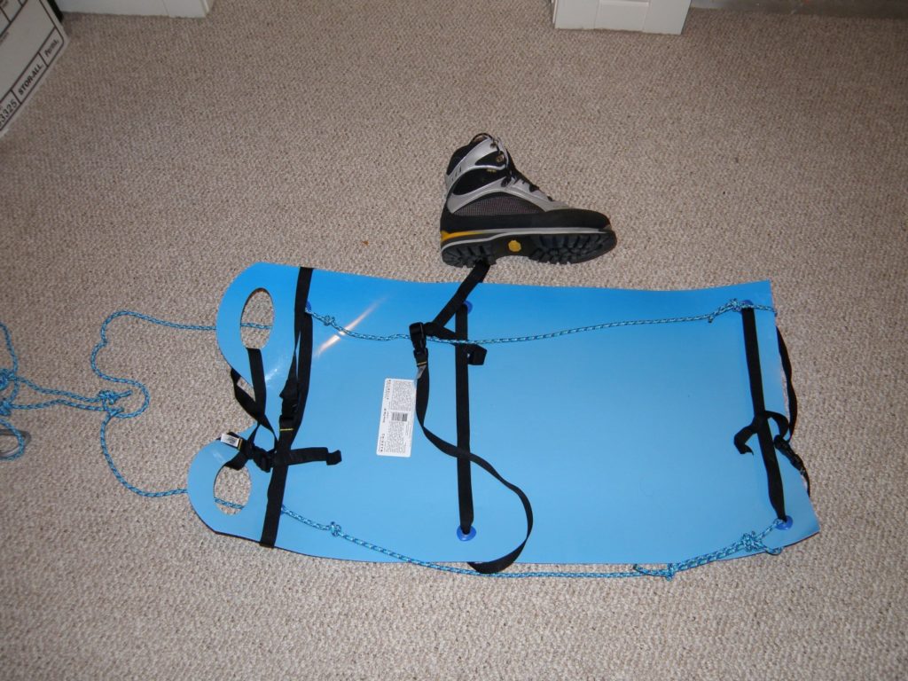
Crazy Carpet sled
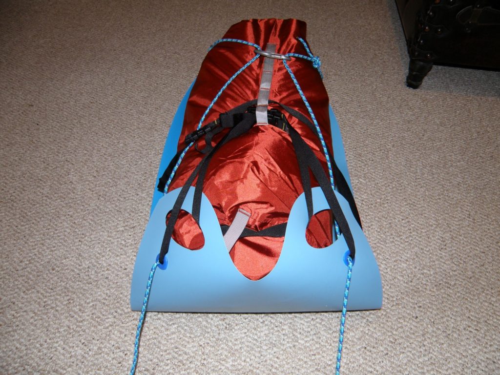
Better to use a smaller 30L hydroseal bag(50L pictured)


Winter camping always involves carrying a lot of extra gear.  I have seen a lot of stuff on sleds and pulks but the simplest idea I have seen is these crazy carpet sleds. This is version # 1 this winter(09) and expext to update with modifications and improvements.  Can Tire Carpet is $3 and weighs nothing so easy cheap setup that slides with very little resistance.  I read one trip report where they used them for a week on a glacier where they moved several times.  A  rigid sled with rigid poles can carry more gear but is a pain on sidehills or on the downhill.  The best info on rigid pulks is Skipulks which has a free downloadable booklet on various buid your own designs as well as expedition quality sleds for sale.

The carpet only needs to last on the way in/up as the idea is to pull the heavy group gear like tent, stove, fuel, heavy food, etc and roll up the carpet and attach to pack on the way out. Note one user has said hers has lasted for 3 or 4 trips so far.   On the way down there is less bulk without the food and less weight without food and fuel.  I like the simple concept for short 2 to 3 day trips. Use plastic tarp grommets to reinforce tie points.

Comments from another user:

1. the sled will pull better if you can roll the sides up a bit as well

– good – I can tighten the side straps which will pull up the sides from the gromments and probably run better in the ski track.

2. Incorporate a bit of bungy cord in your attachment system. It gives a bit and helps when pulling.
Good idea.

3. Make sure it’s securely attached. I’ve seen them attached to backpack straps and the strap blows and the sled careens a 1000 feet down slope narrowly missing crevasses.

– Yikes – separate attach for both cords and an extra safety attach.

4. Don’t load ’em too heavy. Anything over about 30 pounds and they really suck. – Okay

5. I made a bag for mine that zips along the front, so that, in a pinch, I can access stuff if I need it during the day, but it’s far better to only put in stuff that you don’t need during the day. –

Hydroseal bag has roll top and quick buckle entry – face backward.

6.the size of your packed dry bag is going to make it a tough pull if that is the real size of the load you are planning on puling. They do pull better if there is less bulk on the sled.

– Okay – Picture is a 50L drybag – I also have a 30 L drybag – ( works better).   Makes more sense to have each person have a smaller bag/sled than to try carry all the group gear in one large heavy and bulky bag.

I have used 5mm cord just because I had some laying around – can use something much lighter (paracord)and same goes for straps on the sled.
Pictures and more discussion are here.  Ski Sled

Posted in backcountry camping, backcountry ski, Camping, ski, snowshoeing | Tagged , , , , , , , , , , | Leave a comment

Pigeon Mountain Hike Oct 24/09

Pigeon ridge and summit from south peak.


The shortening days and a week of cloudy overcast weather made me crave some outdoor mountain time. Getting up to go to work in the dark doesn’t feel good and even morning workouts and playing hockey 3 times a week does not fulfil the need to exercise outdoors.   I managed to crank off a couple hours of skiing at Canada Olympic Park on artificial snow last weekend but still needed more.   Not enough snow to ski tour so decided to hike Pigeon Mtn.  Trip was about 12.5 km and about 1050m including  60 m for the lower SE summit.  Calgary was raining and just starting a wet snow storm as we left but the mountains were fine and we even got some much needed sunshine.  Summit was cold and windy with some snow pellets but we avoided the big squalls that seemed to hitting the higher peaks.  We went down by bushwacking to the old ski runs but I would not do that without a GPS and it would have been better with more snow – especially for the boulder fields. As an alternative – there was a shortcut down trail/route that comes off the up trail about . 4 km after it come out of the trees – on the left/south of a bluff of trees in a gully.  It would be steeper than the up trail but we saw a cairn and trail that came out about 2/3 of the way up the powerline.

Note that this mountain has closures from Dec 1? to June 15? for wintering and calving sheep herd.

Overall good late season trip to do with hiker friends.  Weather not an issue although miss some of the views.  I kicked or rolled a bunch of rocks off the trail on the way up in case I ever want to ski up to Skogan pass although I don’t know what is covered by the closures.

Pictures are here

Pigeon Mountain

Posted in hike | Tagged , , , , , , , | Leave a comment

Brett Sept 25/09

OLYMPUS DIGITAL CAMERA

p9130428

Brett – about 1600 m and 22 km – 9 hour RT. About 6 hrs up and 3 hours down. Bike trail for 55 min – bike out – 13 minutes!

Brett had never been on my radar but I took a picture from Isabelle a couple of weeks ago and Kevin wanted to do it so I started to do some research.  Sonny and Dave Stephens had it in their top 5 or ten and Andrew and Bob said it was one of the most difficult – second to only Smuts!  Now I was interested.

The bike in was a 55 min  ride and push and we went by some cairns and hid the bikes at the largest cairn by lots of broken rock in an open area.  We found no real trail and just thrashed up the blowdown and deadfall mess – on moss and broken rock – angle up to right to gain hanging valley at most open spot. Travelled up valley on broken rock and then up on right through larch trees/ramps to the low point in ridge.

Hiked ridge for a while until it turns to rock. Two downclimbs.  First one we went down on left side as go down and I cleaned rock off the ledges.   We stuck to the ridge crest as close as could to get full scramble value and usually better rock.  One section of broken knife edge was dicey.  There were usually options to go around difficulties (moderate scramble) on the climbers right /west side but usually looked slabby and down sloping or broken so easier but not necessarily safer.   The second downclimb was a layer of the same poor quality friable fractured quartzite that we had on Isbelle.  We were right on the ridge so we went part way down (5 m)and didn’t like the rock quality – steep, dirty, broken and loose with no good landing.  Rather than backtrack and go down lower and around which looked scrappy and loose, we decided to bring out the 30 m rope, slung some rocks and climbed along the crest which involved a 5m downclimb into a notch and then up a pillar.  The climb back up out of the notch had a fun 5.4 move on the pillar but we felt much safer on better rock.  Vern has a picture of the pillar as he downclimbed it on his way down the ridge.  Rest was easy to summit – close to 6 hours with rope work.  The ramblers apparently bypassed the second downclimb by going 20 m down to the right earlier and around on ledges .  I think it is safest to either do that or the technically harder ridge crest than doing the full downclimb which looked very steep and scrappy.

Good views – somewhat spoiled by smoke.  I am always somewhat wary of alternate descents but this one was 10/10.  We went south to a col and then great scree. Down 3-400 m in 15 min. Then 15 min sidehill down and right to a col on south west side of peak.  Then excellent sheep trail all the way back around to the low point in the ascent ridge.  The peak could be ascended easily this way but the treadmill scree would be murder. Descended into valley and followed easiest open lines along valley bottom and then down through deadfall mess back to bikes.  The 13 minute bike ride was a real rush.

Overall a good stand alone trip with a good descent, good views.  I was not that interested in doing Pilot and Brett on the same trip.  The scrambling on the ridge was fun but I was not impressed with the rock quality in several spots.  Definitely a difficult scramble based on taking the ridge crest or doing the second downclimb – could be a dangerous area if not careful, rushed or tired from doing Pilot.

Pictures are here

Brett

Posted in scramble | Tagged , , , , , | Leave a comment

Isabelle Sept 13/09

OLYMPUS DIGITAL CAMERA


Participants – Kevin, Dave S, Brian H, Marta W, and John. Good company and conversations helped but this was not a favorite trip.  I was busy sat and was not too organized so I did not check the weather or anything.  I was chilly on Murray last week so this time I wore a long sleeve top which did not breathe and I was hot all day. Sunday was probably hottest day of the summer, bright sun and no wind. I drank my 3 liters and then 2-3 more from a stream on the way down.  As I put on my helmet I also remembered that I had forgot to get a haircut so that did not help.  Overall I was overheated and listless most of the day and the loose rock demanded attention.  Way too easy to kick off big chunks.

The scramble is straight forward but the upper mountain is very loose and most of the rock is broken fractured quartzite or sandstone – angular and poor handholds and footing.  We went up the first gully/bowl and escaped onto the RH(SE) ridge -lots of cairns -which we followed around to the left until we hit the cliffs of the upper part. We then traversed left to the first big gully. The crux rockband is at the bottom of this gully and is difficult scrambling  on solid silty limestone for 20-30 ft.  Then up the gully and left onto summit ridge.  Travelled around the left side of summit block and up onto broad summit. The down scrambling required close attention due to the poor rock.  On the way down several of us tried the shortcut across several small ridges/gulleys to ascent ridge and the top of the first gully which went but it was much looser than the ridge route and not really worth it. The Hawk Creek access trail is good but a long walk each way.   Total RT was  ~ 18 km and ~1600 m – a little over 5 hours up and 10 hrs RT.

Great views compared to the smokey/hazy views of most of summer.

Glad to have done it but doubt I will ever be back.

Pics are here

Isabelle

Marta’s pics – good pics of route and upper part of mtn.

Posted in scramble | Tagged , , , , , , , | Leave a comment

Murray/Cegnefs Sept4/09

Murray


Scramble with Kevin on Friday Sept 4.  8 hour RT – Mainly sidehilling and scree slog on bad rock – glad it was partly frozen together.  I can see why this trip is rated so low – “Only for diehard rockies scree fans” was a favorite quote from the trip reports – partly offset by good views.   Three hours to Cegnefs and then another hour and 45 to Murray.  Went in by ski trail and old road on RH side of creek and crossed over.  Went out by old road on south side and Transalta dam and road.  Okay – slightly longer and not necessary as long as creek is low enough to cross.

Snow and frozen rain/hail on upper 1000 ft.

Good talk with Colin J. on hike in. (eighth guy to do the 11,000 footers)

Pictures are here

Murray/Cegnefs

Will add Kevin’s pics later.

Posted in hike, scramble | Tagged , , , , , , , | Leave a comment

Goat Mountain/ridge Traverse 5.3 Kananaskis beside Yamnuska East of Canmore, Canada


p8280214

Goat Mountain Traverse 5.3, Kananaskis, by Yamnuska

p2158895471-o623412657-5

Goat Mountain Traverse 5.3, Exshaw, by Yamnuska

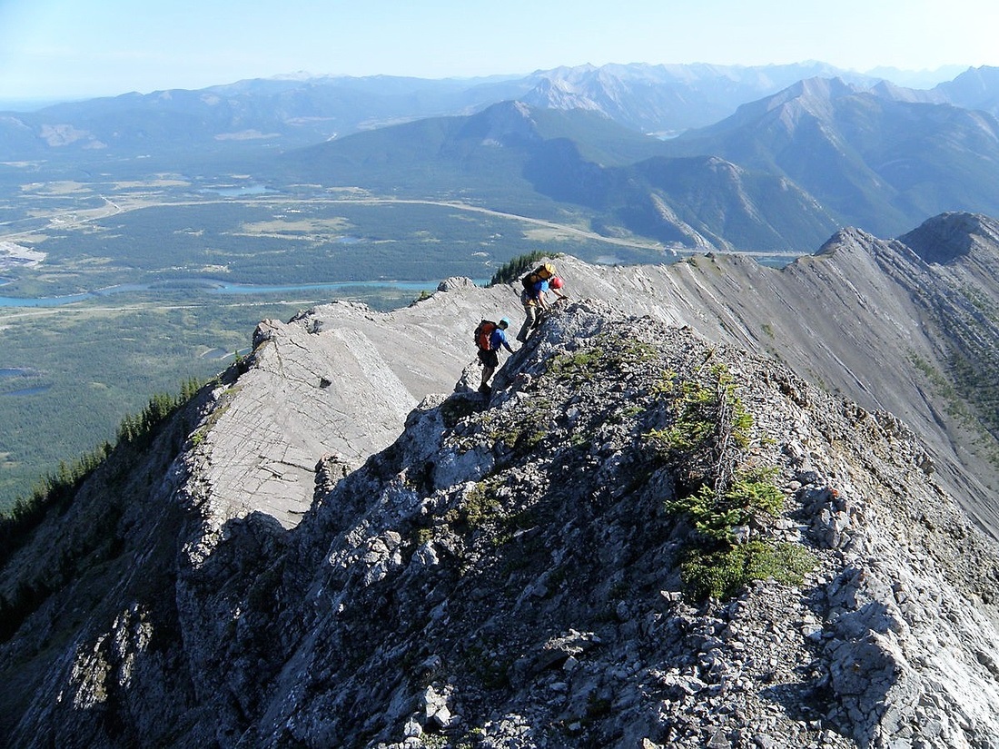
Goat Mountain traverse from North to South or from Yamnuska to Hwy 1A.

This Goat Mountain is East of Canmore and beside Yamnuska and should not be confused with Old Goat Mountain which is South of Canmore and on the West side of Spray Lakes or any of the dozens of other Goat Mountains across the world!

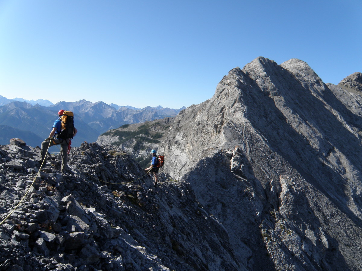
Friday Aug 28/09 with Wietse and Kevin.  About 10 km and 1100 m and 1400 m  total.  We took 13 hours as we did as much of ridge as we could and did 4 raps.  Beautiful sunny day- great time with good guys.  Never harder than 5.3 but not much hiking. Lots of exposure. Used a 30 m single rope, a few slings and some small cams to 2 inch.

Most of trip report is in comments with the pictures.

Interested in feedback on Bypass trail for people going S-N direction(1A to Yam) and where people rapped or got off the SE ridge of Unnamed. Send an e-mail or leave a comment.

Thanks

Pictures are here.

Goat Traverse

Wietse’s pictures

Summitpost Route Description

Posted in alpine climb, rock climb, scramble | Tagged , , , , , , , , , , , | Leave a comment

Gap Mountain Aug 21/09

p8210095

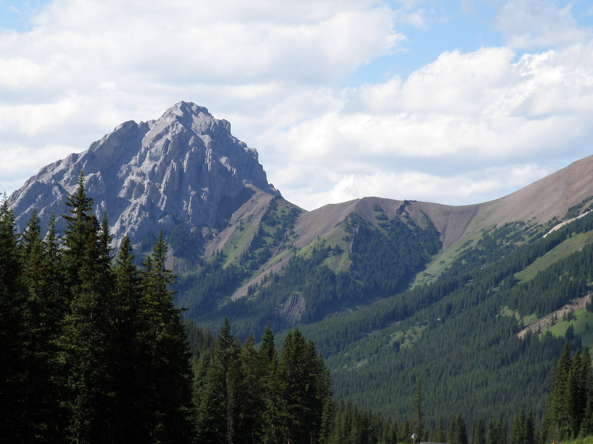
Gap Mountain, Kananaskis, Highwood Pass


Hiked up to base of Gap with a buddy.  Explored on the rock but too loose and exposed for a hiker.

Tried out a new camera – Olympus 565UZ.  My friends with DSLR’s will howl but I have owned top quality SLRs and I am not a good photographer so the extra capability is wasted on me.

The ease of use and advantages of a small lightweight(13 oz.) ultra zoom(20X) offset the disadvantages for me.  The ultrazooms do have slightly poorer image quality, are slower and don’t do as well in low light conditions but  I was able to pick up the 565 at a discontinued price of $320 CDN so it is a cheap experiment compared to a DSLR.

Pictures are here – check out the tele shot of a weather station and the butterfly shot.

Gap Mountain

Posted in hike, scramble | Tagged , , , , | Leave a comment

Niles Aug 8/09

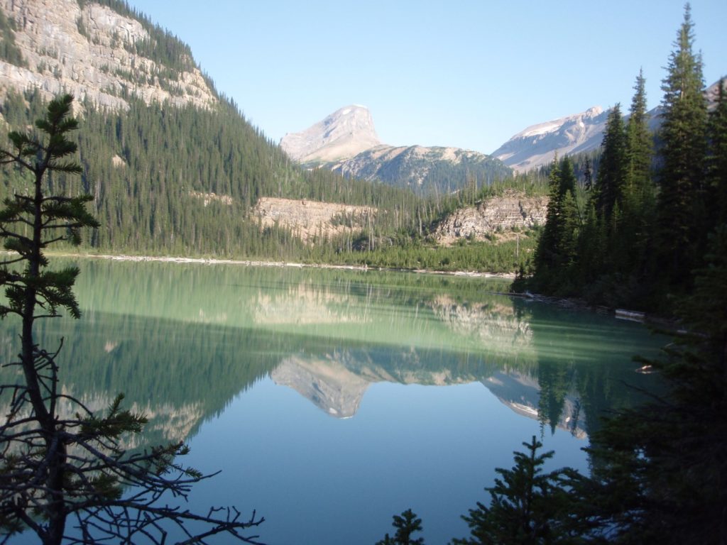
Sherbrooke lake and Niles


Great trip with Wietse and Kevin. Good views but for the haze.

Long walk – 24 km – 1350 m – 9 hrs RT

Very good trail to Niles meadow and also up East side of valley to base of Niles.  Best/fastest to use drainage gully directly to Niles up and down and best to bypass most of boulder field on the west and circle around to left (NW) of lowest pinnacle and then right of big pinnacle.   Reasonable up trail from there.  Mostly hiking as only took my hands off the poles once on the upper ridge.

Niles Aug 8/09

Wietse’s Pictures

Posted in hike, scramble | Tagged , , , , , | 1 Comment

East Stanley Ridge – Ball Attempt 2 Alpine climb

OLYMPUS DIGITAL CAMERA

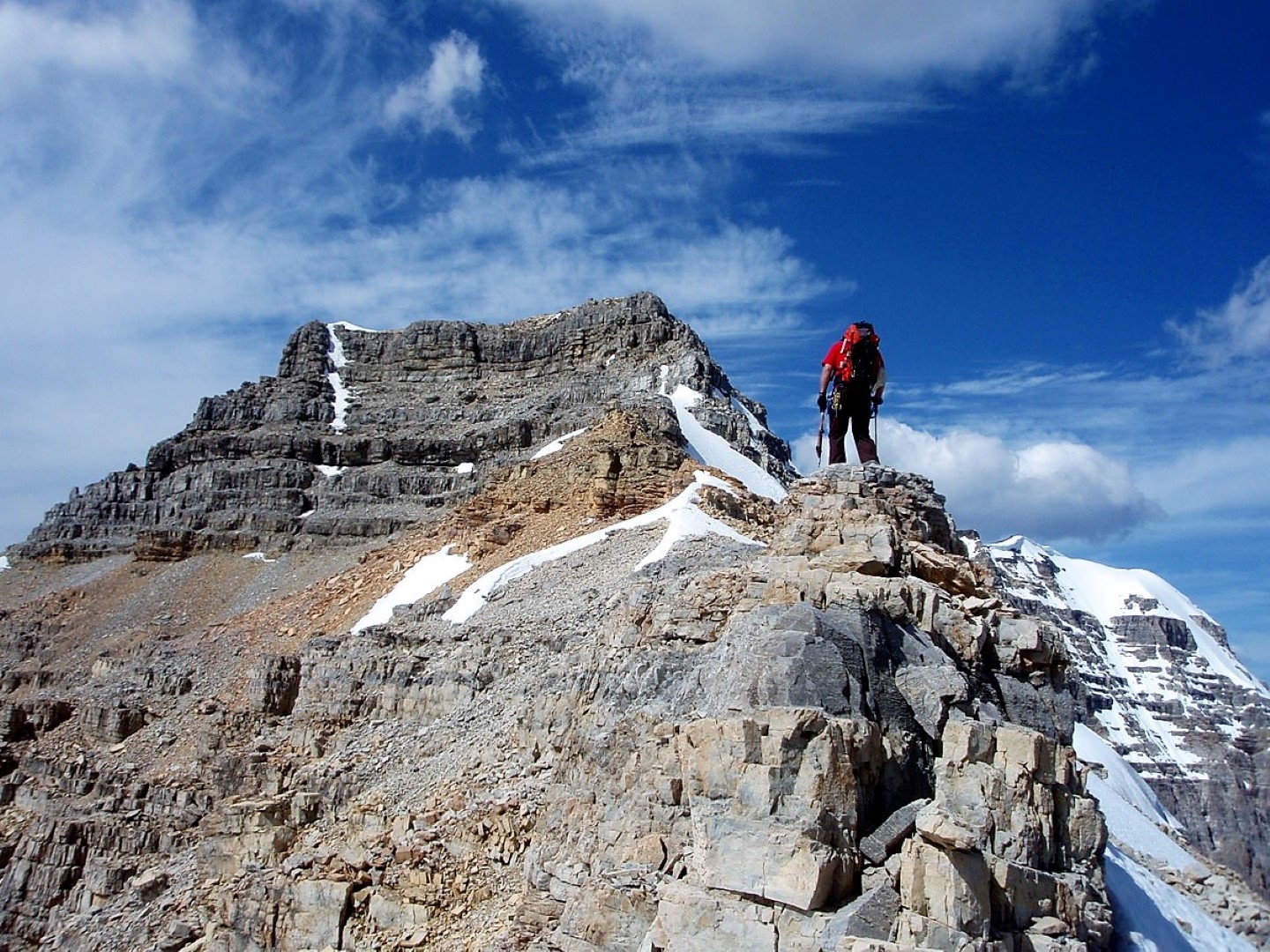
East Ridge of Mount Stanley – Mount Ball attempt


Great Alpine climb along East ridge of Stanley in an attempt to ramble along the continental divide over Beatrice and do Mount Ball. Stopped by 5th class bump before Beatrice- lack of equipment, poor rock, route finding and time. Overall great adventure in fantastic setting.

We did 1700 m and took 14 hrs RT.   Note really need to do this as two day by bivi in stanley valley and start early. Total elevation gain will be 2200 to 2300 m.

Pictures are here. Second click gets bigger pic but lose comments   East Stanley Ridge-Ball Attempt 2

Added some pictures from Scott.

Scott’s pictures

Posted in alpine climb, rock climb, scramble | Tagged , , , , , , , , , , , | Leave a comment

Stanley Valley July 10/09

Nemisis

Wet reconaissance hike.

Pictures here

Stanley valley july 10/09

Posted in hike | Tagged , , , , , , | Leave a comment