
Lake Agnes and Tea House, Lake Louise ski area and Redoubt behind. hike Banff
Sunny day hike with the family. Some beta shots of Victoria, North Victoria and Aberdeen.
Pictures at lake agnes
Lake Agnes and Tea House, Lake Louise ski area and Redoubt behind. hike Banff
Sunny day hike with the family. Some beta shots of Victoria, North Victoria and Aberdeen.
Pictures at lake agnes
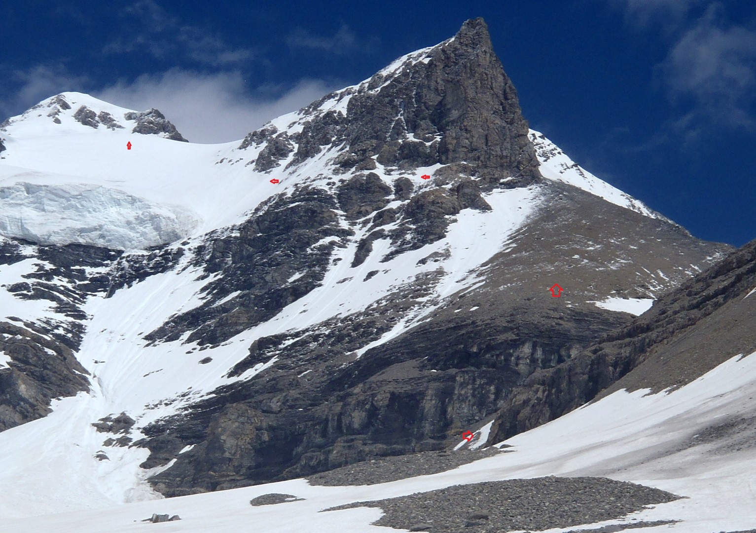
King George route
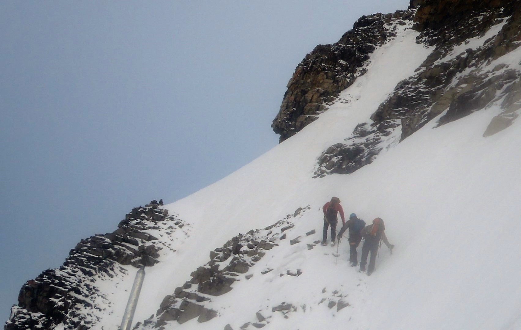
Traverse on King George
Big trip – three days – access by mining and logging roads (settlers road) Height of the Rockies BC provincial park and then cross log foot bridge. wet hike in on mainly game/elk trails for x km and 1000 m to camp/bivy in valley beside princess Mary/x creek.
Up at 2:30 am, walk on mainly firm snow Mark’s report below:
We climbed Mt King George by the south face yesterday (July 16).
The bridge over the Palliser is in good shape, with a wire handrail. A couple of 4 ft 2x4s lag bolted into the log would be a good addition to replace the wobbly posts that are there at the moment.
The trail up Fynn Creek is well flagged most of the way. We camped in the valley to the south of Princess Mary to avoid the King George glacier/black slot approach.
From camp to the summit was almost entirely on snow with only a short section of talus. The traverse ledge was snowy and challenging. Snow conditions on the upper glacier were not that good on the steep traverse (breakable crust over wet snow) but got better higher.
There was convective fog on the south side of the mountain for much of the morning and this was to our benefit as it kept things cool. If the sun had come out earlier we would have had to bail before the summit. Conditions deteriorated rapidly as soon as the sun came out and for the second time in a week I was glad to be off steep snow slopes before 11 AM.
Mark Klassen
Mountain Guide
Ben Firth
Asst. Alpine Guide
Photos: www.facebook.com/alpinism
Kevin’s writeup – Mt King George
Last weekend myself, Bill Kerr and a good friend Roy Stadelwieser undertook the journey deep into the Royal Group to climb Mt King George.
Our original destination was Mt Sir Douglas or Whitehorn (N Face) with our extremely reliable guide Mark Klassen.
We have employed Mark on a half dozen climbs since over the years. Roy has employed him steadly over the years and together they have knocked off many of the elusive 11,000ers. Roy says they have never been denied a summit they had set after.Snow conditions were not considered “premium” so we settled on Mt King George and its never ending approach.
By reputaion, King Geoge is not a very difficult Mountain. The approach is supposedly quite long and the local environment is very scenic.
Well the rep is well earned on all accounts except that it is much more involved than we had figured. Also I have to say. Its Big. Really big, and thanks to Global Warming it is snow free from 2000m down.Now the quick report.
Three hours drive from Banff , turned on Settlers Road and went to about km 60. Parked the truck and checked out the log bridge that crosses a large creek(Palliser River) not far from the road. The bridge was safe with hand rail and small planks to help with safety. I was still nervous in the crossing (Fell in at Mt King Edward) but it went well.
Soon we were on the trail and soon it began to rain. For 6 hours we hiked following flagging, elk trails and guess work into a little patch of paradise (not the camp in the book) but on the West side of Mt Princess Mary.We were soaked when it was time to sleep. And it rained for while longer.
2:30am we were up and at em, leaving camp at 3:45 (still soaked) we were soon on the snow which started right at our camp. Still soaked we gained elevation for an hour, then swung right (east) to intersect the route that is described in the book. We put on crampons and roped up here. (no longer soaked).The next stage was a delicate traverse (on snow covered ledges)to the left. Usually this portion of the climb is a scree/talus slope which people can easily walk across.
This time it was front pointing on 40+ degree slope. Very exposed to slip and potential rock fall from above. After a few hundred meters of this we began to gain elevation again.
Now above the large hanging glacier, we were at about 3100m. The day was looking good, so we had to hurry before the slopes became dangerous.
Kicking steps straight up for almost an hour we finally made the short ridge to the summit.
One of the best things about our sport is “summit time”. taking in the views, high fives, pictures and a good lunch. We had to do it all in 15 seconds. Time was a wasting.
Racing down, we made the top of the airy traverse just before the sun hit it. In only a short while we were bombarded with falling snow, ice and small stones.
Bill’s rope was only a few minutes behind and he informed us afterwards that there was very little left of our buckets that were kicked in the now soft snow. Lots of big sluffs.
Good thing that Bill can still move like a 20 yr old when he has to.
After the traverse we were able to relax and enjoy the sun. Soon harness, ropes and crampons were put away and an easy boot ski to the tent was next.
The hike out was non eventfull, as the weather was now excellent. The only thing to report is the potential hazzard our trip was able to avoid, Killer Marmots. Very big, very brave and hopefully with very little memory capacity.
This is an excelent trip, but lots of research is encouraged. Please refer to Bill’s website for more info or better yet get one of us out for coffee. The approach is very complicated but the SW bivy is the best way to get up this thing fast. 9 hrs tent to tent.
Thanks for the adventure boyz.
Pictures at King George
Ben’s website

Fisher Peak – Ridge Cranbrook
Not to be confused with Fisher Peak in Kananaskis See Fisher Kananaskis
Went to Moyie Lake for my Mom’s 80th birthday clebration. Was to continue to USA but forgot passports so stayed around lake a few extra days and got talked into an attempt on Fisher.
Too much snow given I only had my runners with no heel and no ice axe.
Also had to park 1-2 km and 150 m early due to avi over road. Trail was not bad but lost it in the rocks a few places so made some good cairns on the way down.
Trip is billed as x km and 1400 m.
pics at Fisher Peak

A good short early season training type day. Bike approach from Nakiska road worked well- 6.5 km vs 8.8 km from barrier dam.
I will let Kevin Papke tell this one.
Well our good friend Scott has finally accomplished a goal he set out to 30 yrs ago. Mary Barclay’s Mtn.
Early in his illustrious climbing career, at the tender age of 17 he and his personal chauffeur made an attempt at a winter ascent of this elusive peak. The story is just another of many almost forgotten epics that we on this board so often get to partake in. Needless to say, it is worth ones while to hear Scott relate the experience in his own words.
The entire experience can be summed up in one simple phrase. “Young and Dumb”.
Now in 2011 an experienced Scott with two accomplises repeated that epic journey from so many years ago. This time it was with no hazzards, snow, or life threatening decisions.
Mary Barcleys Mtn is a very, nice well graded moderate scramble in the front ranges. We encountered no snow on the entire trip and with the sun shinning brightly, the feeling of a mid summer day in K country was hard to ignore. We had a perfect day. The 1st since 2010.
To avoid crossing the raging river we did bike approach which took about 1/2hr each way(45 min). After a short discussion we decided to follow Scott’s original line of ascent up the right hand (most northern of the 2 east ridges) that rise above the valley floor. From below this route looked like it would be the most entertaining of the two, much in the same nature as say DoorJam Mtn. Mostly just a steep hike, but a few interesting rock steps, some mild exposure (rotten rock) but nothing worth putting your poles away for.
Half way up this ridge, the terrain laid back for a short distance before what appeared from below as a steeper (possibly more more difficult) section was to follow. This was not to be the case though. Nothing but a steep walk up scree, talus and dirt was to take us to a high point above where the described route in a Andrews book joined up.
Here we took our first break, where we were able to study the final ascent route and soak up some wonderfull sunshine. I think we were 2 hours from the car at this point.
We lost a wee bit of altitude walking along the ridge before the final push for the summit. The scrambling here was again more walking than scrambling and we had only two sections of decent hands on scrambling, both about 30m. Niether in any way more than the lower end of moderate, rock is excellent in both spots.
Our time to the summit was 3hrs 17minutes with a bike approach, and 20+ minute break below the summit ridge. It was decided to descend the same way but 1/2 way down we took the described ascent route (southern most of the two ridges) and this turned out to be a good idea, as we experienced excellent scree on the way down.
The trip out to the bikes and ride home was without issue, easy and flat.
If I was to do this trip again, it would be recommended to repeat both the lines of ascent and descent to minimize the scree on the way up, and maximize it on the way down.
Thanks for the great day Bill and Scott.
The bike ride does have some up and down with one creek crossing – max 18 inches deep but easy enough.
Pictures at Mary Barclay
Scott’s Pics
Quick trip on Sunday for exercise with Kevin and Lars. A little over 2 hours up – 1.5 down.
Some snow in trees and patches on Loder.
Rest of mountains look very white. Drove down to Mt kidd and not much looks dry but lots of cars at Baldy and Wasootch peak. Nakiska runs still have snow right down to the lodge which confirms the pics I saw of people skiing on corn – unbelievable for Mid May!
Watch for wet avalanches – any time of day with no overnight freeze.
Be careful out there.
One tick – makes your skin crawl!
No pics.
Pics from a previous trip
Note Doorjam and Loder are also South end of Goat traverse

Summit of Saint Nicholas Peak Wapta Icefield ski

Lower Ramp Route on Balfour, Wapta Traverse
Note marked route picture up Balfour ramp Large version.
Four day traverse from Bow Lake over the icefields to exit at West Louise Lodge on Highway 1.(Sherbrooke Lake exit)
About 40 km and about 1500 m of elevation gain and loss depending on peaks climbed. We climbed Saint Nicholas but we were in whiteout/snowing at Balfour col so didn’t get Balfour. ( 1750 m if do Balfour)
Stayed at Bow Hut, Balfour hut and Scott Duncan hut.
Thanks to everyone for a great trip and especially Scott for organizing.
Thanks also to Clayton for the use of some of his pictures.
Wapta traverse pictures – use full screen slideshow.
Feel free to download copies of anything. Go to largest version and right click to download. Contact me if you want a higher res version.
Wietse’s writeup and pictures Wapta Traverse
Trip Notes for next time:

Annual trip into the Blanket Glacier Chalet which is SW of Revelsoke in the Monashees. Snowing for most of the time so was skiing in the trees. The alpine – above tree line was wind affected and slabby so we avoided it and any large open areas. I had a bruised hip from hockey and IT band issues so not as much skiing as I wanted but good time as always. Some new people joined the group this year – Kerry and Blanka and Bruce and Robyn.
Pictures here Blanket 2011
Kerrys Pictures – some good pictures of people actually skiing!
Bruce and Robyn’s pics –
Note previous years trip pictures can be found under Ski Trips tab at top.

Note full size pic in Pics
Headed out with Scott and Wietse to do Circuit – Healy Pass to Egypt Lake and out by Red Earth Creek trail. New snow/trail breaking slowed us down a bit and no tracks beyond Healy Pass so we decided to just ski back down Healy creek versus coming out in the dark. Nice short day with good weather and a few turns at the pass. Some good pics back at Simpson Pass/Sunshine area so could see where we went several weeks before.
Also looked at a potential gully route through the cliffs and trees for a run down off Wawa ridge to West or SW which would come out on the Healy Crk trail near the second slide path. Have heard rumours of guys doing this for years but never have focused on a feasible route. Definitely would want better avi conditions. There are 2 or 3 steep avi paths farther north that would be really questionable but there is a treed gully that looks doable in the right conditions although finding it from above might be hard.
Pics at Healy Pass Feb 5/2011
Wietse’s pics
Scott’s pics
You know there are less people in the backcountry when this blog gets 77 unique visitors(max has been 82) and 239 page views in a day! Two thirds of those are probably spammers but that is a lot of traffic. Note new max was 419 pageviews in a day in July 26/2011 and then 470 pageviews in a day in Jan/2012.

Healy Creek Pass Sunshine Ski Traverse

 Dec 30 Wietse and I decided to do Chic Scott’s trip in reverse. Note all pics are Wietse’s – Thanks.
I had unsuccessfully looked for this route before so I was not sure of the down route and thought it might be easier to find the route through the cliffs from below. We got lucky as someone had broke an up route trail recently.
I did not expect to go all the way to Simpson pass but the trail took us there and then got us to the top of the steep dense trees and then to a series of hills and ridges that led to the flat area on the North side of Twin Cairns. We went around the South side of the hill just North of Twin Cairns and to the top of Wawa Chair.
I read over Chic’s description again and I think the down route is actually to the South of where we went. Anybody done this? Pictures?
Also in the guide book – the initial direction from the top of the Wawa chair is to “angle off Northeast to the notch in the ridge North of Twin Cairns” – This is obviously supposed to be angle to the Southwest!
I put some maps with our GPS route in the pics. Unrushed 4.5 hours to Wawa chair with some trail breaking, pictures and breaks. Cold.
Pics at Healy-Simpson-Sunshine