Stuart Knob – Castle Mountain North Peak Scramble July 15, 2018

Stuart Knob Scramble Banff Castle Mountain

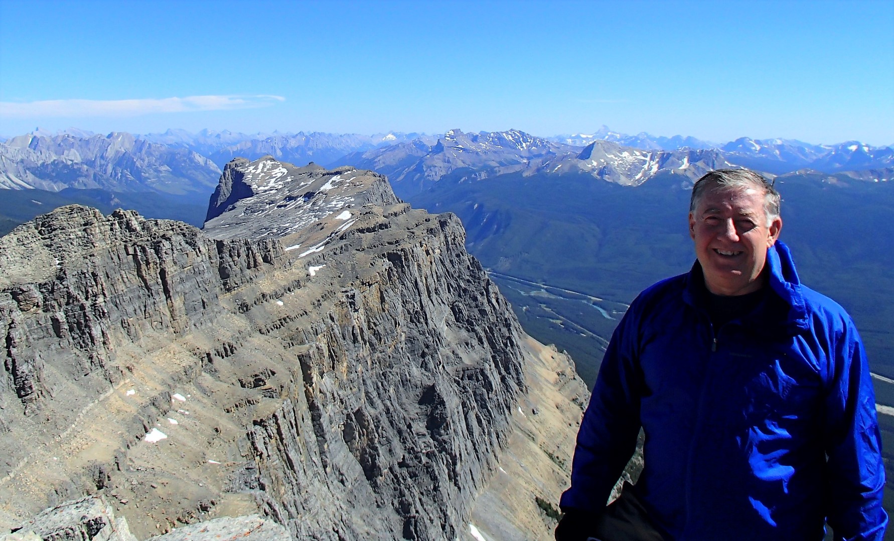
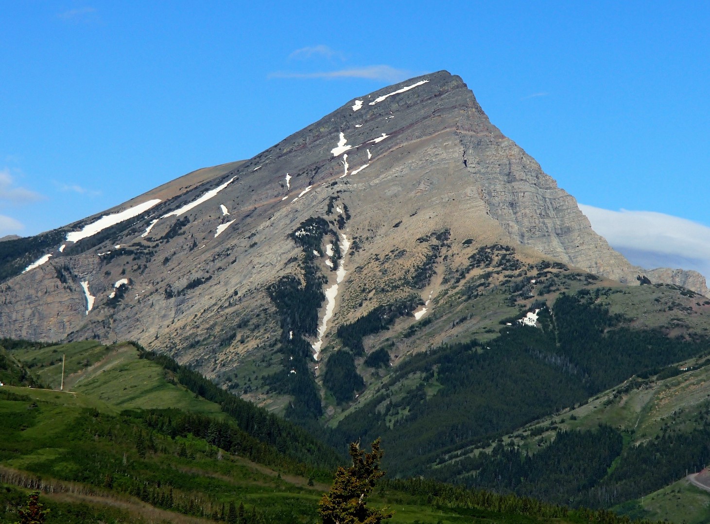
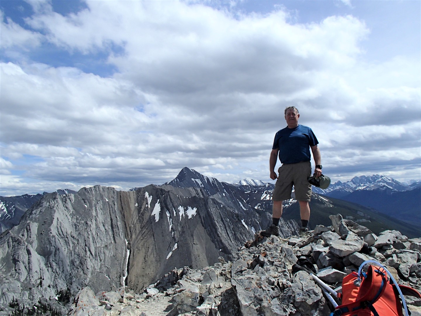
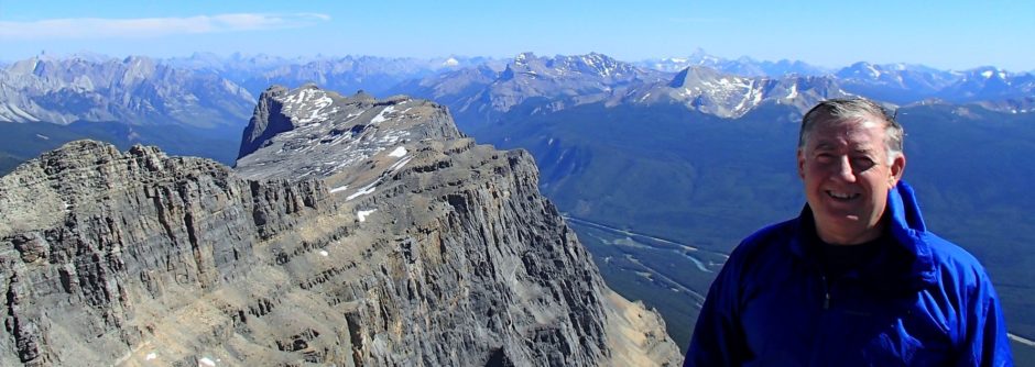
Castle Mountain from Castle Mountain North Peak, Banff

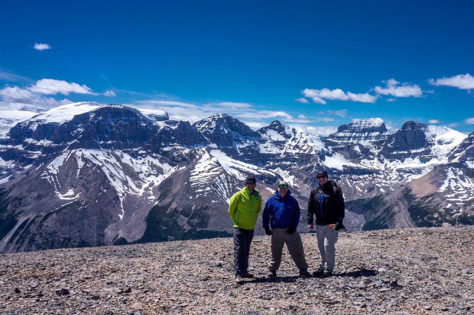
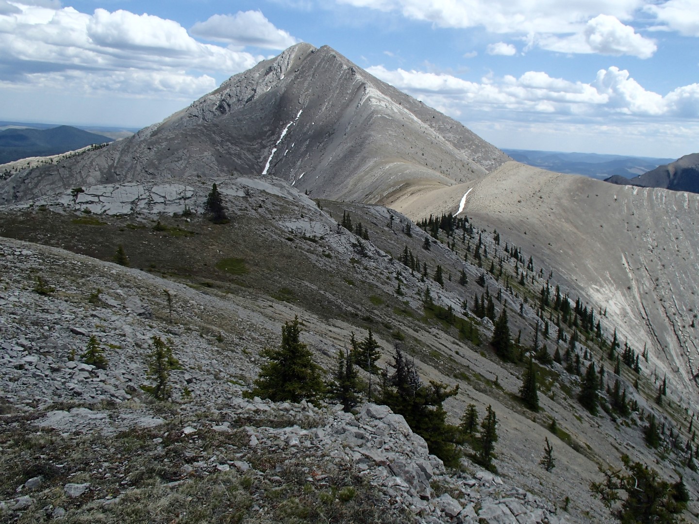
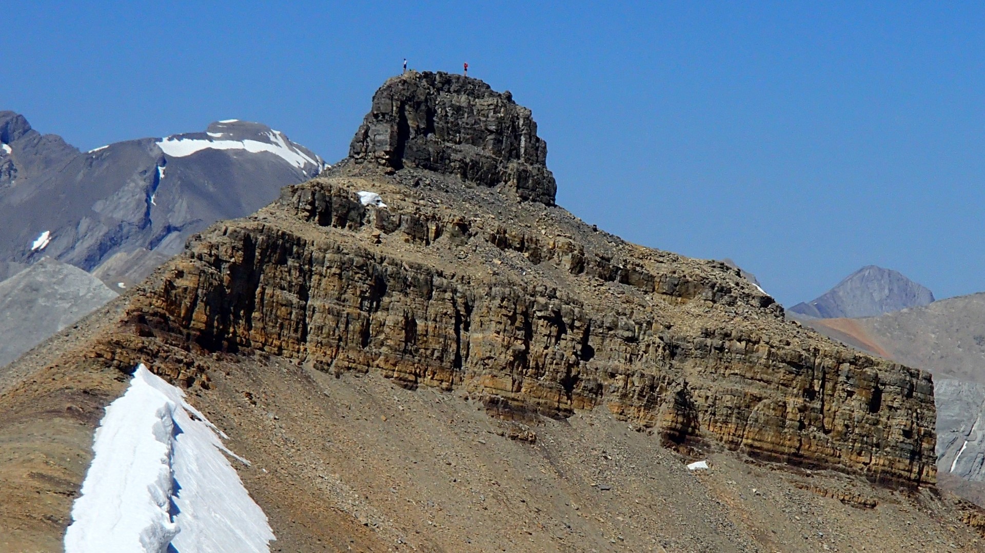
Stuart Knob and Castle mountain North – true summit.

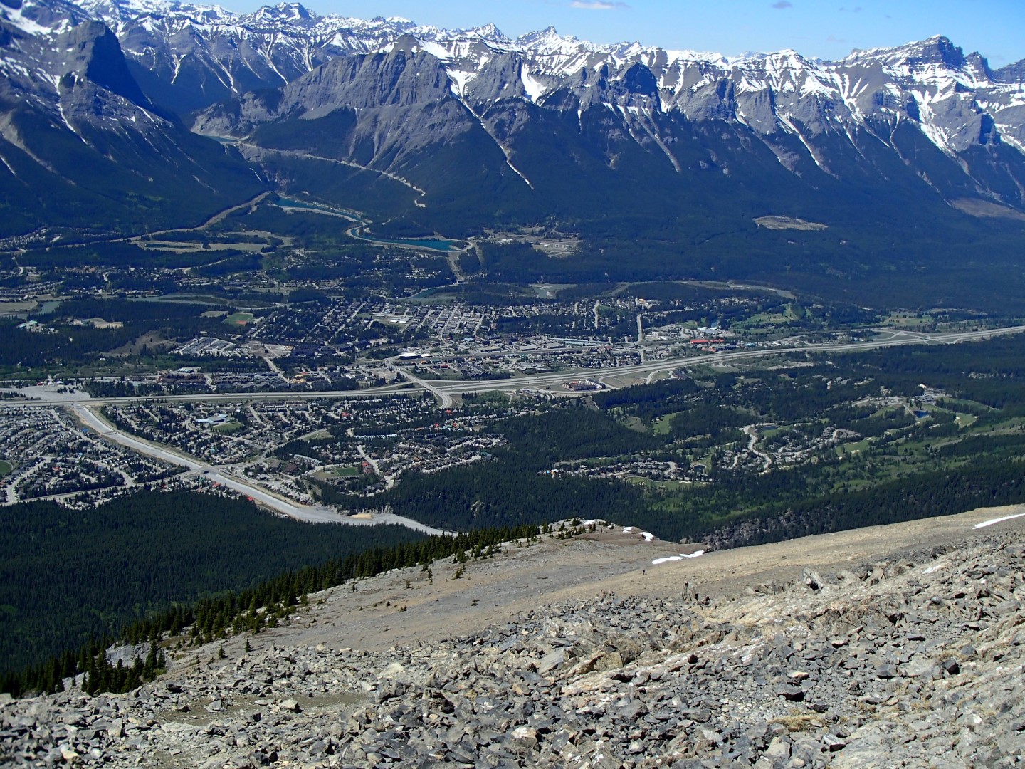
Long walk – about 29 or 30 km and 1600+m and 12.5 hours with breaks.

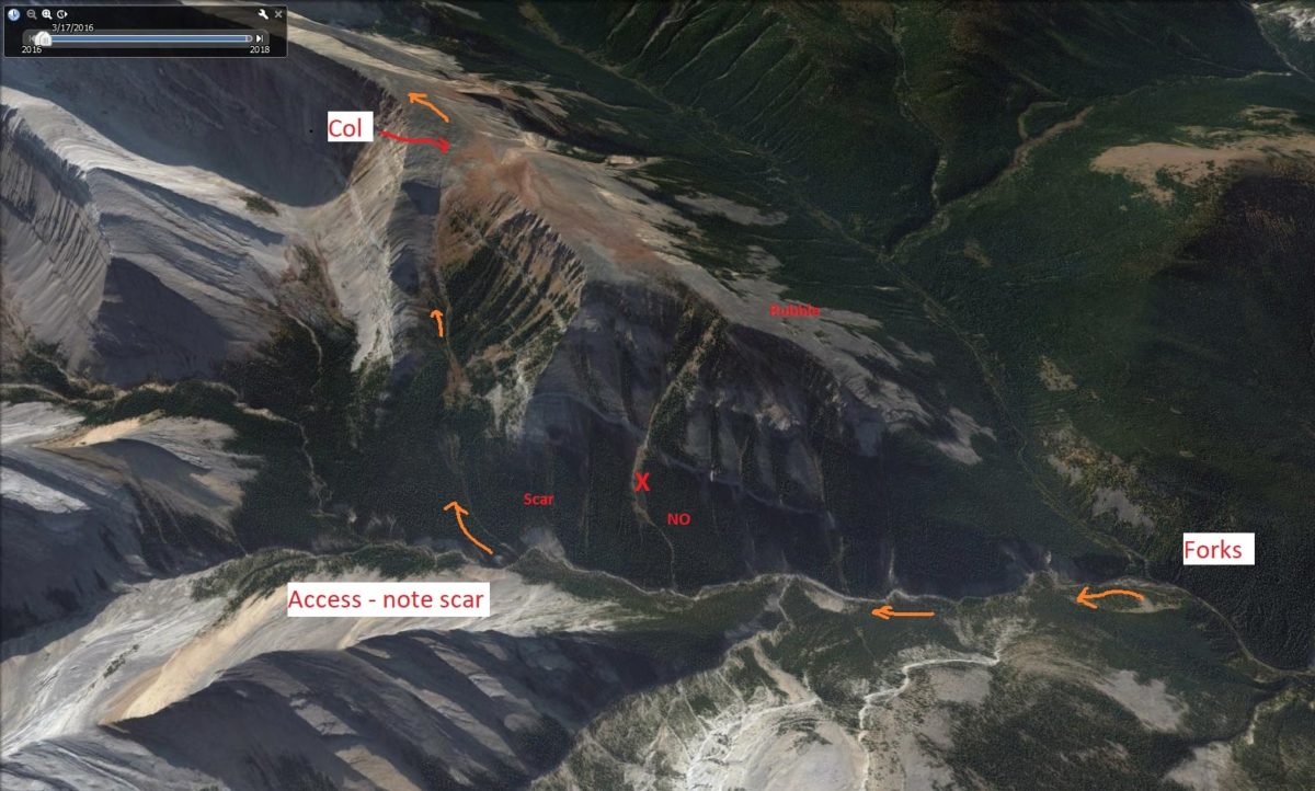
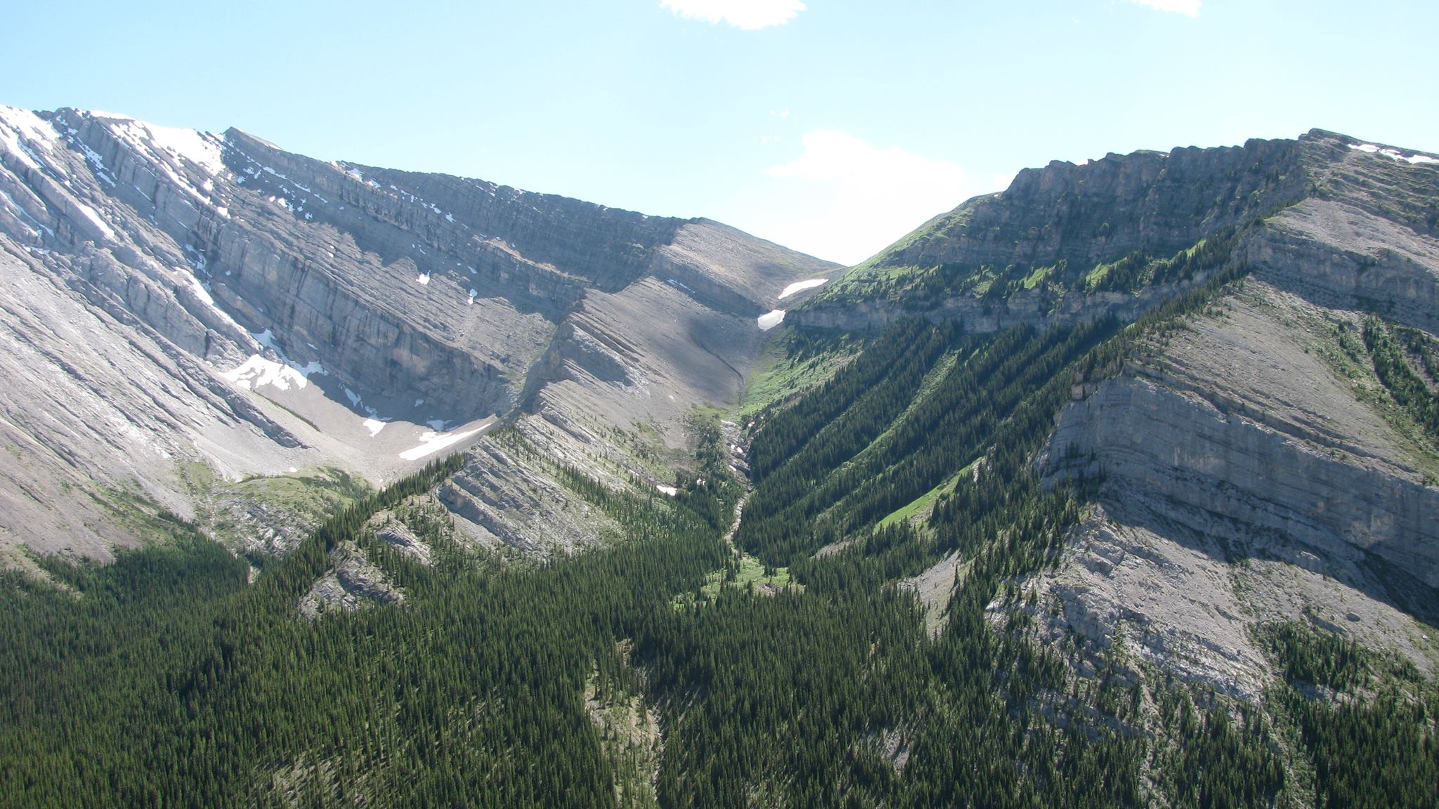
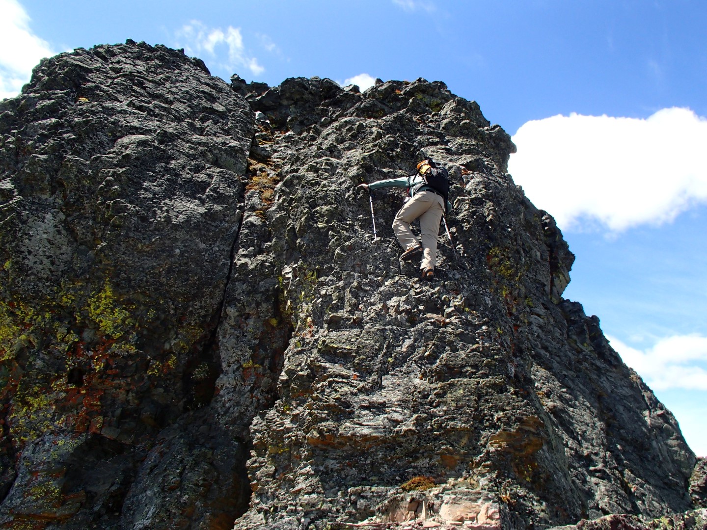
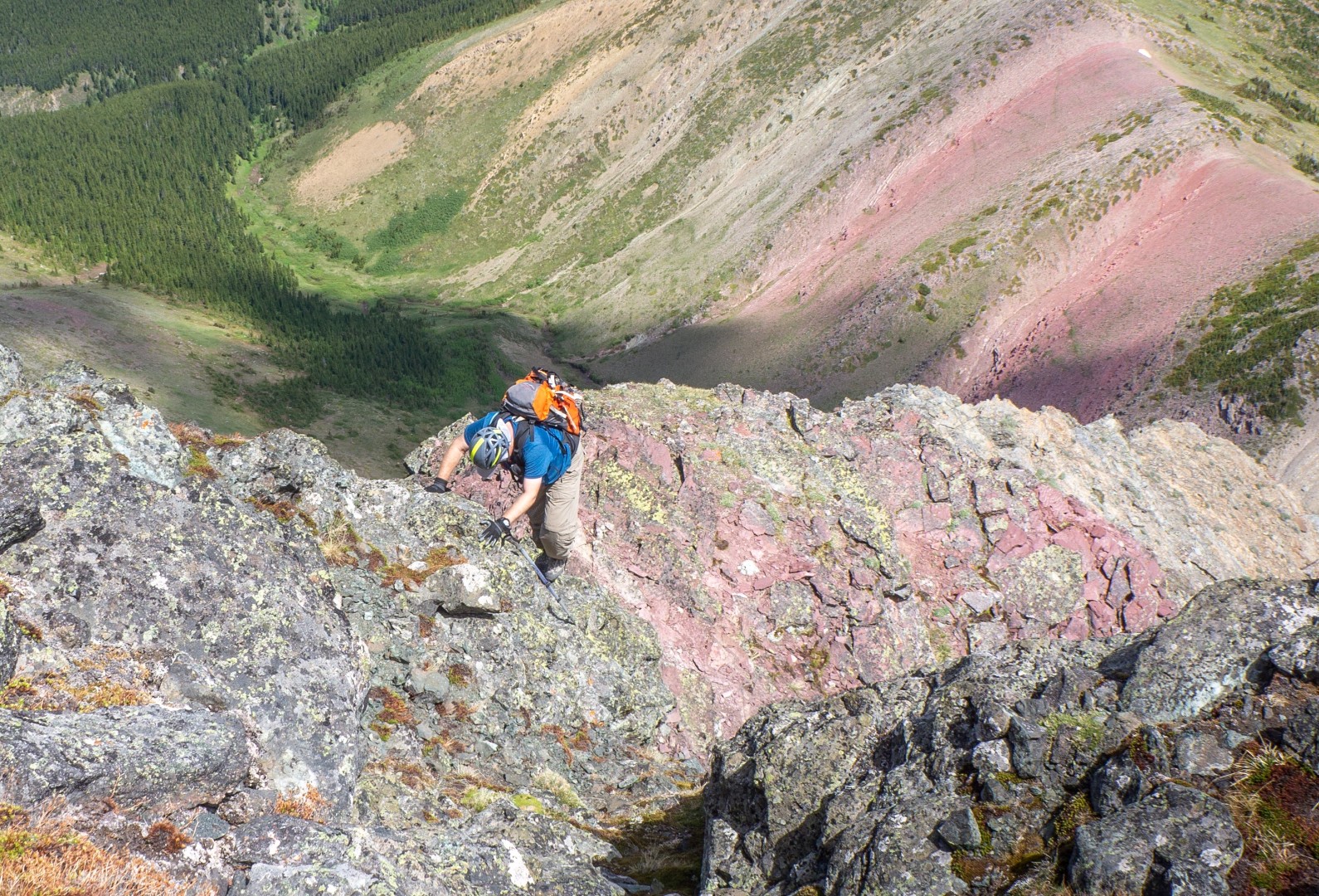
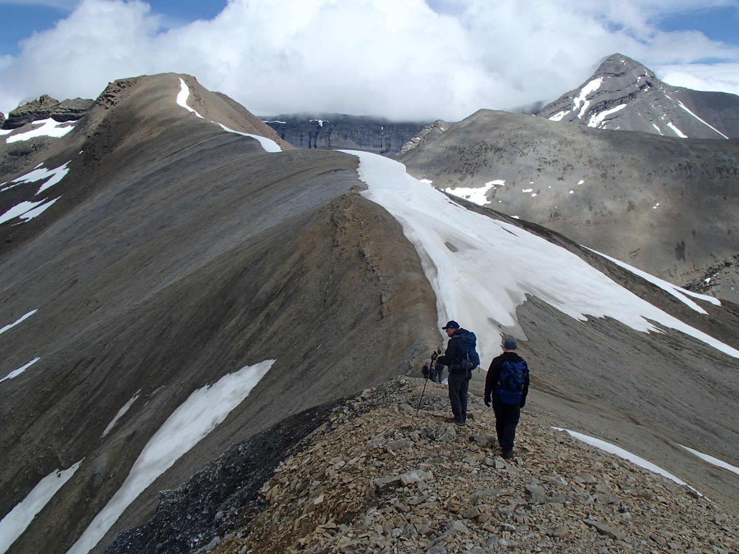
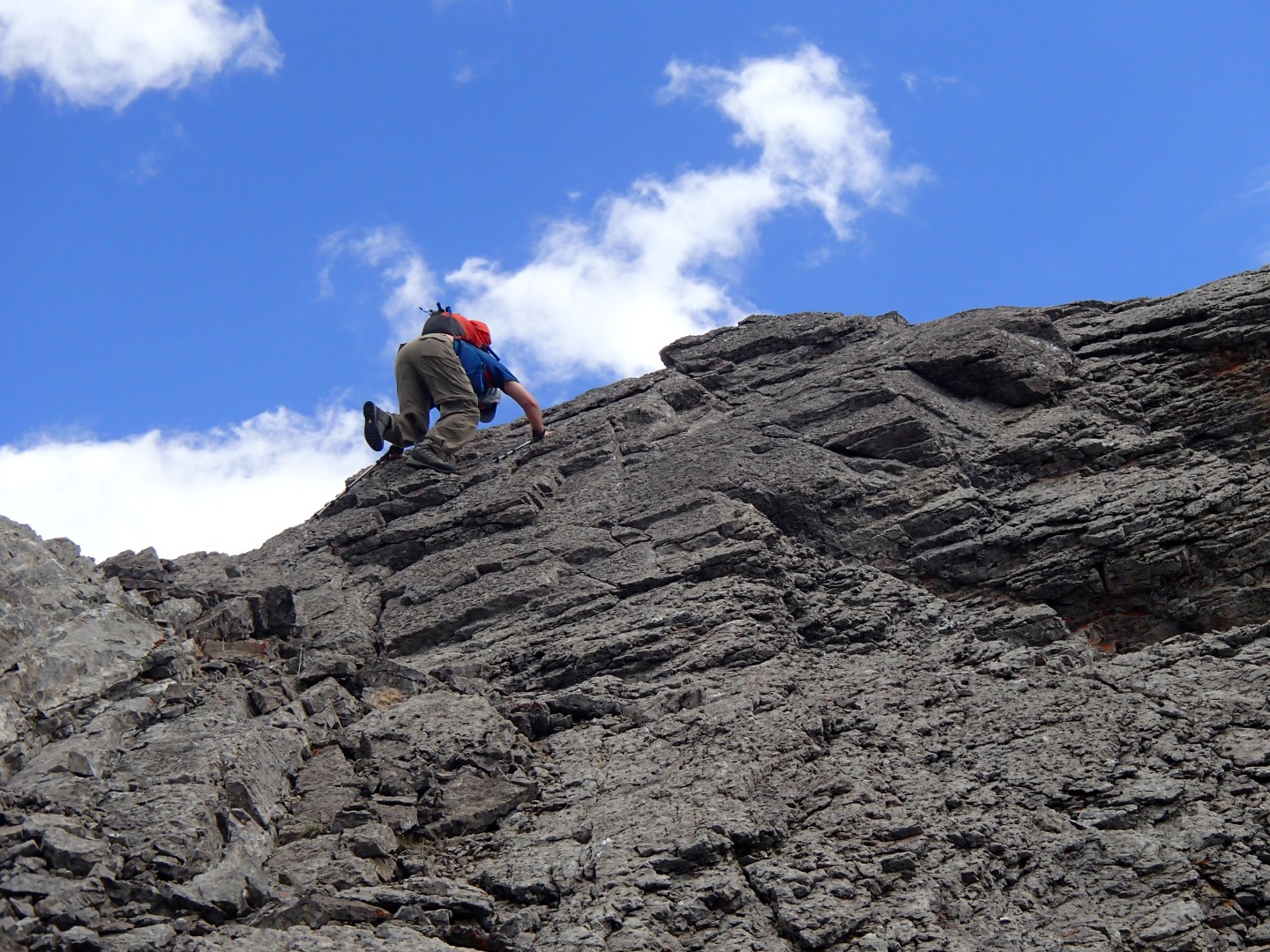
Gained basin and across limestone pavement then cut right up scree through weakness in rockband(no trail currently?) to gain col/ridge between Helena and Stuart knob. See pics. Followed ridge to base of stuart summit and then left along base and ledges to bypass snow. Stuart has short scramble on back. Good views. Then along ridge to Castle North. Easy on dirt and then broken rock along RH side. Rolled some rocks to improve path which helped on way back. Much better viewpoint than Stuart – see pics.

Note on Castle – can bypass top of bump on left side above lake and cross lower plateau and up ramp on castle side. Shortens the walk and saves wasted elev gain.

PICS – slideshow best but lose comments

Posted in scramble | Tagged , , , , , , , , , , , , , , | Leave a comment

Fisher Peak Kananaskis Scramble N – NW Access to Col at Mid Ridge July, 2018

Follow left creek bed at Forks and pass a steep creek and then a scar on right bank. Ascend a drainage and follow easily to col. This approach bypasses the terrible rubble on West aspect

Fisher Peak Kananaskis NW Drainage Access – pic from Adrian Cornescian – thanks

Probably best access to the col in middle of the Fisher Peak Ridge. At Forks – follow left creek bed to past a steep creek and then a scar on the right bank and follow an easy drainage up to the col.(see maps in Pics)

More creek bed but lower angle, easier travel up and down, no elevation loss over west ridge highpoint, and avoids the ugly rubble on the West side of ridge.

Collection of google Maps and pics from various trip reports off the internet. Thanks to whoever I got pics from.

PICS

PICS from 2006 scramble

Summitpost TR

Fisher Peak Route Description https://www.summitpost.org/north-west-ridge-on-fisher-peak-kananaskis-5-3/433000

Posted in scramble | Tagged , , , , , , , , , | 4 Comments

Kidd South Scramble Kananaskis July 1, 2018

Kidd South Scramble July 1, 2018 

With Kevin K

1525 m 14.5 km

4 snow storms slowed things down – climbed all the high points as couldn’t see anything.

The rubble on upper part is bad but there is a ok down trail along ridge and down drainage to west and then cut back to regular up drainage.

PICS


Posted in scramble | Tagged , , , , , , , , , | Leave a comment

Tangle Ridge June 27, 2018

Tangle ridge june 27, 2018

With Wietse and Kevin.  Some pics from Wietse – thanks

1200 m and 11.8 km.

Pics

Posted in scramble | Tagged , , , , , , , , , | Leave a comment

Paleo Quartzite Biface Knife/Scraper Stone Tool Alberta Pincher Creek

Paleo Quartzite Biface Knife/Scraper Alberta Pincher Creek

Paleo Quartzite Biface Knife/Scraper Alberta Pincher Creek

Paleo Quartzite Biface Knife/Scraper found on Victoria Peak. Dated between 6,000 and 12,000 years old. We were descending a drainage with multi-colored limestones and shales(reds, tans, yellows) and the grey color and shape caught my eye. At first I thought it was a spear point but no notches or fluting and has a rounded bottom.

The maker would have used an antler point to pop flakes off to create the sharp edges. That design and material was in use from 12,000+ years ago by the Clovis people and subsequent peoples. There is a Clovis site in Montana(12 to 13000 years) that is not far away.

The drainage is a funnel with natural choke points so hunters could have driven game(sheep?) down the drainage to waiting hunters with spears or bow/arrows. There is still a sheep herd on the mountain.

Reported it to the Alberta Archaeology Dept and they created an archaeological site.

Pictures – see pics at end of folder

Posted in scramble | Tagged , , , , , | Leave a comment

Victoria Peak Scramble June 13, 2018 Castle Paleo Quartzite Knife

Victoria Peak Scramble – Castle area

Victoria Peak Scramble – Wietse on crux over window.

Looking down at crux over window. I am near top of crux. Victoria Peak scramble castle area

Victoria Peak – 14.1 km 1094m   6.5 hrs RT  under 4 hrs up

Bike 2.7 km 130 m so 930 m up in 3 hrs 15 min

34% grade

Went west on ridge and down by brown scree and an avi bowl/path that had a trail.

Picked up a paleo quartzite knife/scraper.  see pics – some are Wietse’s and Kevin’s – Thanks

Pics

Posted in scramble | Tagged , , , , , , , , , | Leave a comment

Red Peak Kananaskis Scramble June 9, 2018

Ridge leading to Red Peak Kananaskis on left. Bogart off to right.

Scramble with Kevin Papke and group.

My GPS watch says 1060 m and 17.8 km RT.  Max 2780 m.   About  4.5 hrs up and 3 hrs out

Rain most of way in but cleared up a bit in afternoon.

Lost the trail on way up to pass  as went too high and off to left so took wrong grass strip up to pass.

Snow drifts on other side of pass so went up peak to left and went too high and across loose crap to col with red peak ridge. On way back took a level line across side hill loose crap to top of snow and then back down to pass.  Met a solo polish backpacker who had illusions about going to Ribbon Lake but too much steep and deep snow. Hope she turned around as rained and snowed at altitude last night and today.

Pics    – second click for larger pics or use slideshow but may loose descriptions/comments

Posted in scramble | Tagged , , , , , , , , , , | Leave a comment

Wasootch Peak Mountain Scramble June 3, 2018

On Summit of Wasootch Peak – Skyline – Kananaskis Peak, Old Baldy and Fisher L to R

Sunday afternoon with Kevin K.

900 m 6.5 km RT

2hr 25 min up and 1 hr 35 min down.

Trail is much more established now.

Pics

Posted in scramble | Tagged , , , , , , , , | Leave a comment

Maze Peak Scramble Yaha Tinda area May 25, 2018

Maze Peak Scramble Ya Ha Tinda area from puzzle point/west peak May 25, 2018

Scramble on Maze Peak Ya Ha Tinda area

Slabby scramble on Maze Peak Ya Ha Tinda area.

First new peak this year. Good scramble with Kevin Papke on a flex friday.

About 850 m to peak but 1000 m overall within regain and added puzzle point to west.

Just under 3 hours to top including breaks and photo ops. 6 hr RT with side trip to west point for views and extra exercise.

Took hardest scramble lines on every slab or rock point so fun moderate rock in some places. Most had easy walk arounds.

Best road is to drive to Sundre and the west.

Trail head past km 14, down to creek/bridge, pass slide scar and park 1-200 m as go up hill(3-400 m past bridge.)

Best to go right and up through thinning trees and aim to gain right hand shoulder of ridge vs straight up looks scrappy dinner plates over broken rock.

See spirko for good map but maybe start more to the right.

Pics


Posted in scramble | Tagged , , , , , , , , , , | Leave a comment

Grotto Mountain Scramble May 19, 2018


Canmore from Grotto mountain scramble acc route

Grotto  Up 1250 m in 4 hrs on ACC route to first summit (312 m/hr) but ran low on time. 8.5 km RT

Summit 1400 m gain.(Kuz tagged it)

Down 1250 m in under 2 hours.

Pics

Posted in scramble | Tagged , , , , , , | Leave a comment