with Kevin K and Wietse.
Chased off by rain and buzzing metal about 60 m short of summit.
940 m, 15 km and 6 hours.
Rained on us about 4 times.
with Kevin K and Wietse.
Chased off by rain and buzzing metal about 60 m short of summit.
940 m, 15 km and 6 hours.
Rained on us about 4 times.
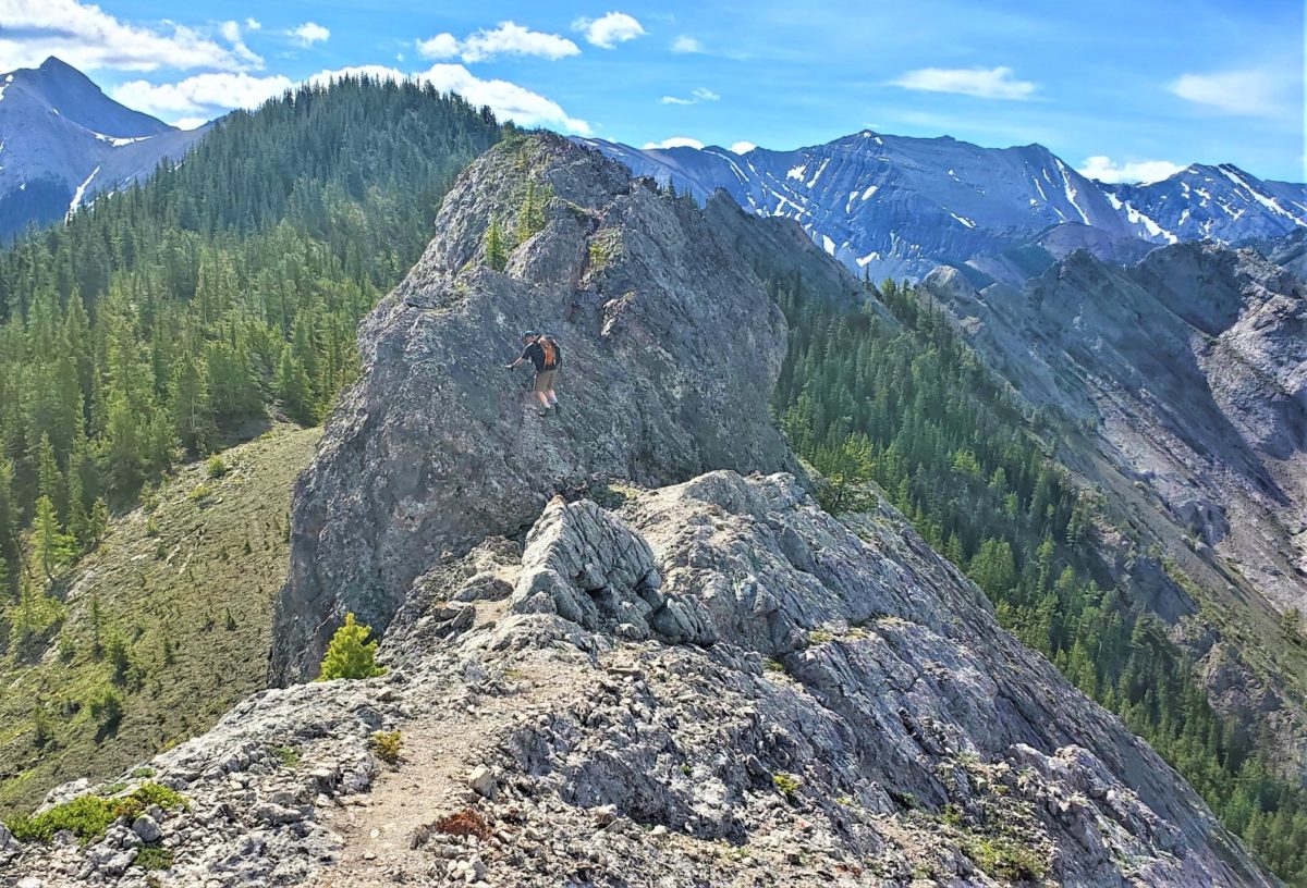
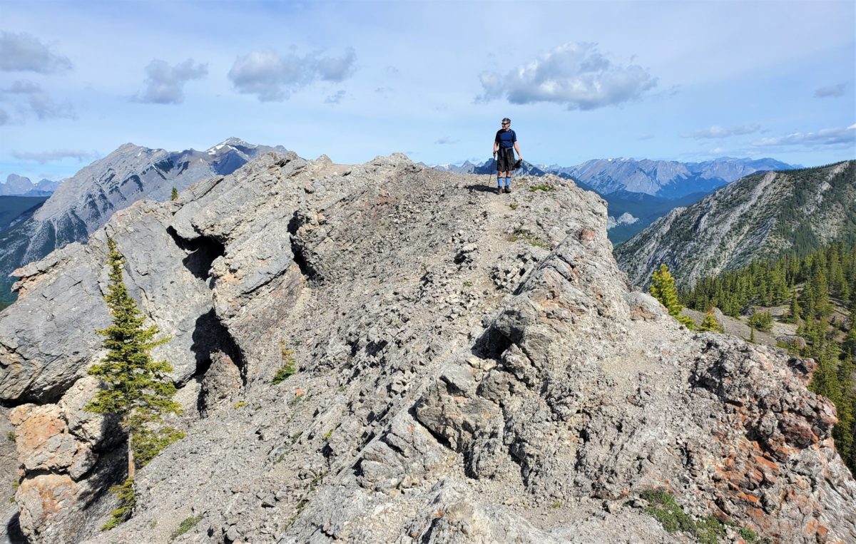
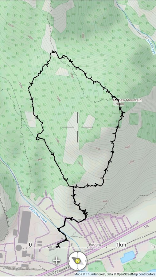
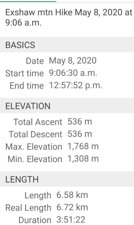
Nice hike/scramble with Kevin and Roy.
Note easiest to cross river on bridge to South side and then recross to North side on some logs. Cross again after splits to base of ridge. ridge a bit steep but good trail. Went up all rocky high points except the tower off south side.
Bike and hike with Dave, Kevin P and Wietse.
Went to new bridge versus cross river after campground. Worked ok but extra km’s. Poor trail along river back to correct drainage. Good trail on RH side of river from horse camp most of way up Rose in trees. Weather rolled in and decided to turn around.

Hike scramble near Cranbrook with Kevin P and Gary H. Some snow near tree line and along summit ridge.
About 11.6 km and 1370 m in 8 hours including time waiting while guys did Teepee.
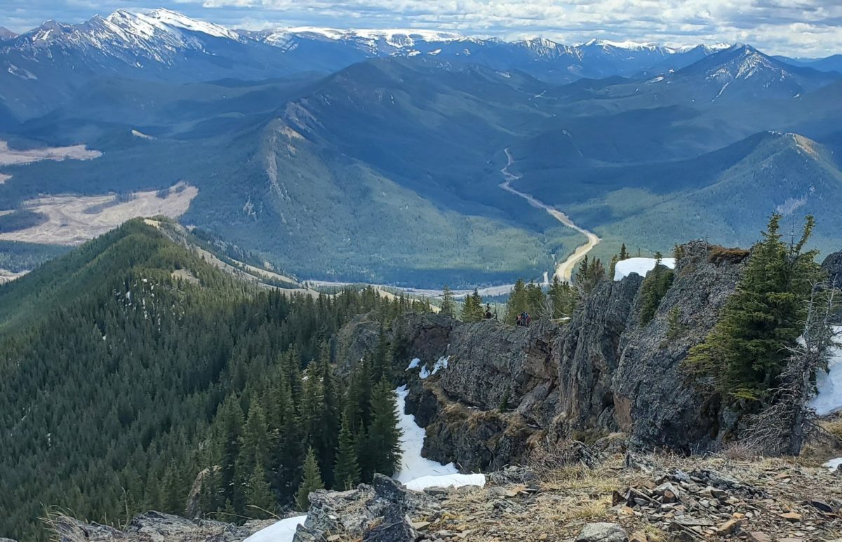
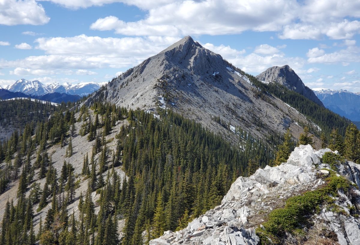
Nice hike/easy scramble with Kevin K.
Started from the gate on East side of stream and went up grassy/treed ridges from highway and joined East ridge about 1/3 the way up at a weakness. Almost stepped on a 6 foot garter snake in the rocks.
Followed ridge easily to top with some easy scrambling on rock but probably avoidable.
Summit has big cairn. went down west ridge and lost trail in broken rock and trees. trail swings off to east side and then back to west. follow ridge down to saddle and then follow old road or various shortcuts down to road.
Loop is 8.7 km and 760 m in relaxed 4.5 hrs.
Mostly easy walk to pass with some snow in trees. Heavy snow there after with some spots well over 2 m deep. Lots of people and trails but no over night freeze so all falling apart.
Did about 550 m before decided to go home.
Parked at school park lot and went across new bridge and over to trailhead,
Dry to summit in 1 hr 15 min from car and then decided to do loop which involved slow post holing to waist in the rain/sleet down to col and then follow flagging down to Prospector MB trail back to trailhead.
Bike riding, dog walking, stairs and basement workouts.
Trail was hard snow so carried snowshoes to summit. 400m?
Recognized Steve Tober from his pictures and had a good chat. We both picked this trip because of Sonny’s report. Smaller world than usual.
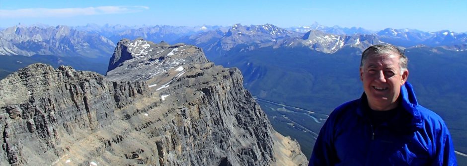
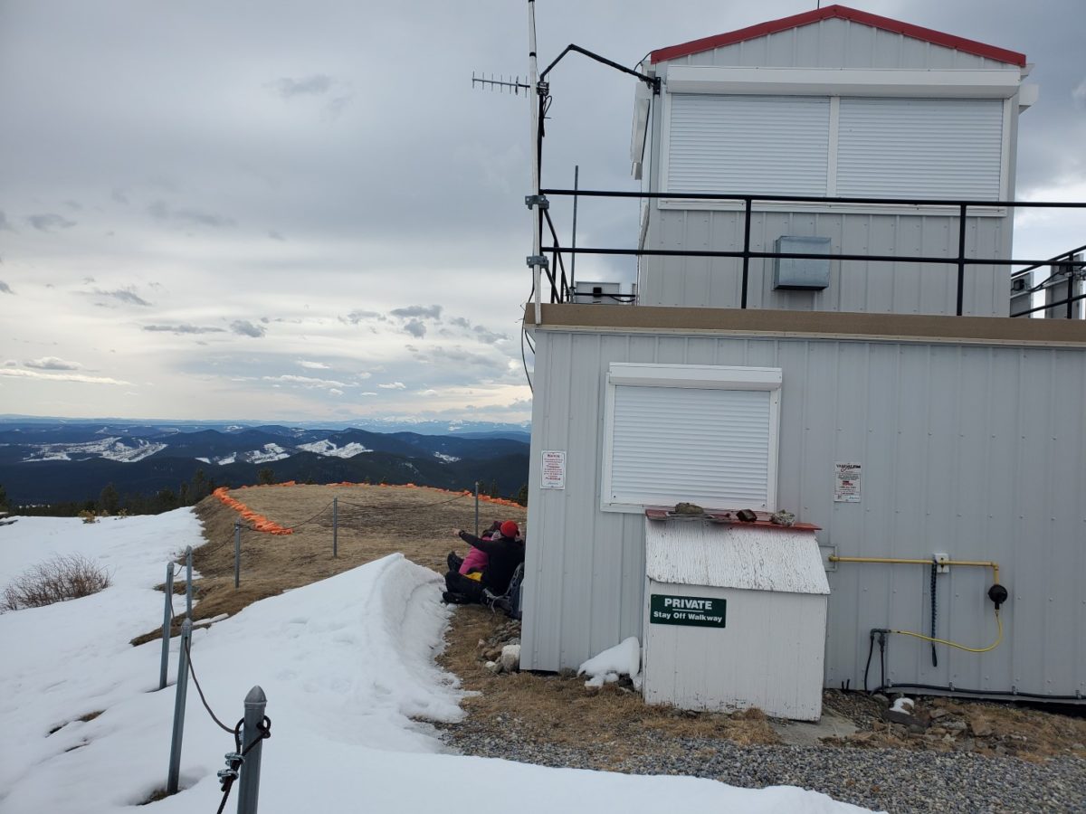
Tested the tactical antenna and could hit Blue Hill(30+ km to North), Barrier Mtn(40km to South) and Moose Mtn(60 km to SE! – line of sight). Impressive. Buzzz Kachunk.