King George route
Traverse on King George
Big trip – three days – access by mining and logging roads (settlers road) Height of the Rockies BC provincial park and then cross log foot bridge. wet hike in on mainly game/elk trails for x km and 1000 m to camp/bivy in valley beside princess Mary/x creek.
Up at 2:30 am, walk on mainly firm snow Mark’s report below:
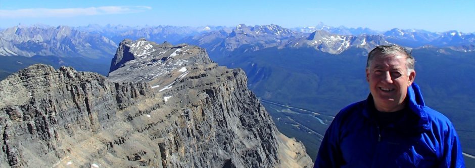
We climbed Mt King George by the south face yesterday (July 16).
The bridge over the Palliser is in good shape, with a wire handrail. A couple of 4 ft 2x4s lag bolted into the log would be a good addition to replace the wobbly posts that are there at the moment.
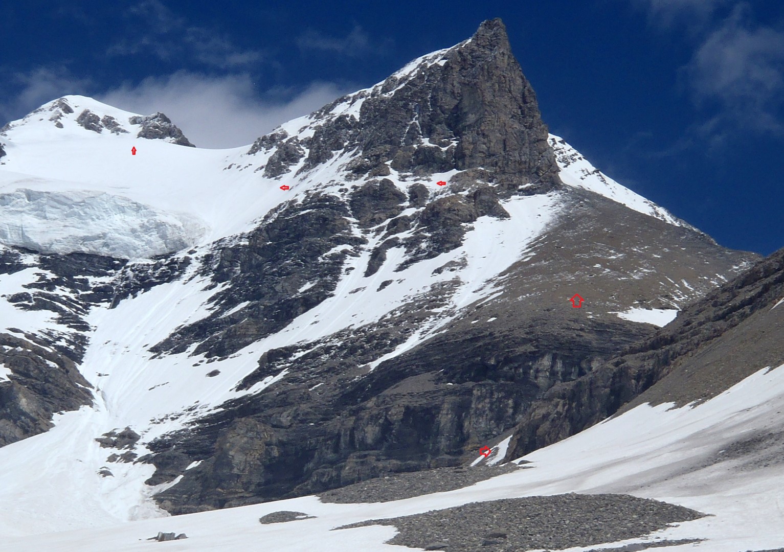
The trail up Fynn Creek is well flagged most of the way. We camped in the valley to the south of Princess Mary to avoid the King George glacier/black slot approach.
From camp to the summit was almost entirely on snow with only a short section of talus. The traverse ledge was snowy and challenging. Snow conditions on the upper glacier were not that good on the steep traverse (breakable crust over wet snow) but got better higher.
There was convective fog on the south side of the mountain for much of the morning and this was to our benefit as it kept things cool. If the sun had come out earlier we would have had to bail before the summit. Conditions deteriorated rapidly as soon as the sun came out and for the second time in a week I was glad to be off steep snow slopes before 11 AM.
Mark Klassen
Mountain Guide
Ben Firth
Asst. Alpine Guide
Photos: www.facebook.com/alpinism
Kevin’s writeup – Mt King George
Last weekend myself, Bill Kerr and a good friend Roy Stadelwieser undertook the journey deep into the Royal Group to climb Mt King George.
Our original destination was Mt Sir Douglas or Whitehorn (N Face) with our extremely reliable guide Mark Klassen.
We have employed Mark on a half dozen climbs since over the years. Roy has employed him steadly over the years and together they have knocked off many of the elusive 11,000ers. Roy says they have never been denied a summit they had set after.Snow conditions were not considered “premium” so we settled on Mt King George and its never ending approach.
By reputaion, King Geoge is not a very difficult Mountain. The approach is supposedly quite long and the local environment is very scenic.
Well the rep is well earned on all accounts except that it is much more involved than we had figured. Also I have to say. Its Big. Really big, and thanks to Global Warming it is snow free from 2000m down.Now the quick report.
Three hours drive from Banff , turned on Settlers Road and went to about km 60. Parked the truck and checked out the log bridge that crosses a large creek(Palliser River) not far from the road. The bridge was safe with hand rail and small planks to help with safety. I was still nervous in the crossing (Fell in at Mt King Edward) but it went well.
Soon we were on the trail and soon it began to rain. For 6 hours we hiked following flagging, elk trails and guess work into a little patch of paradise (not the camp in the book) but on the West side of Mt Princess Mary.We were soaked when it was time to sleep. And it rained for while longer.
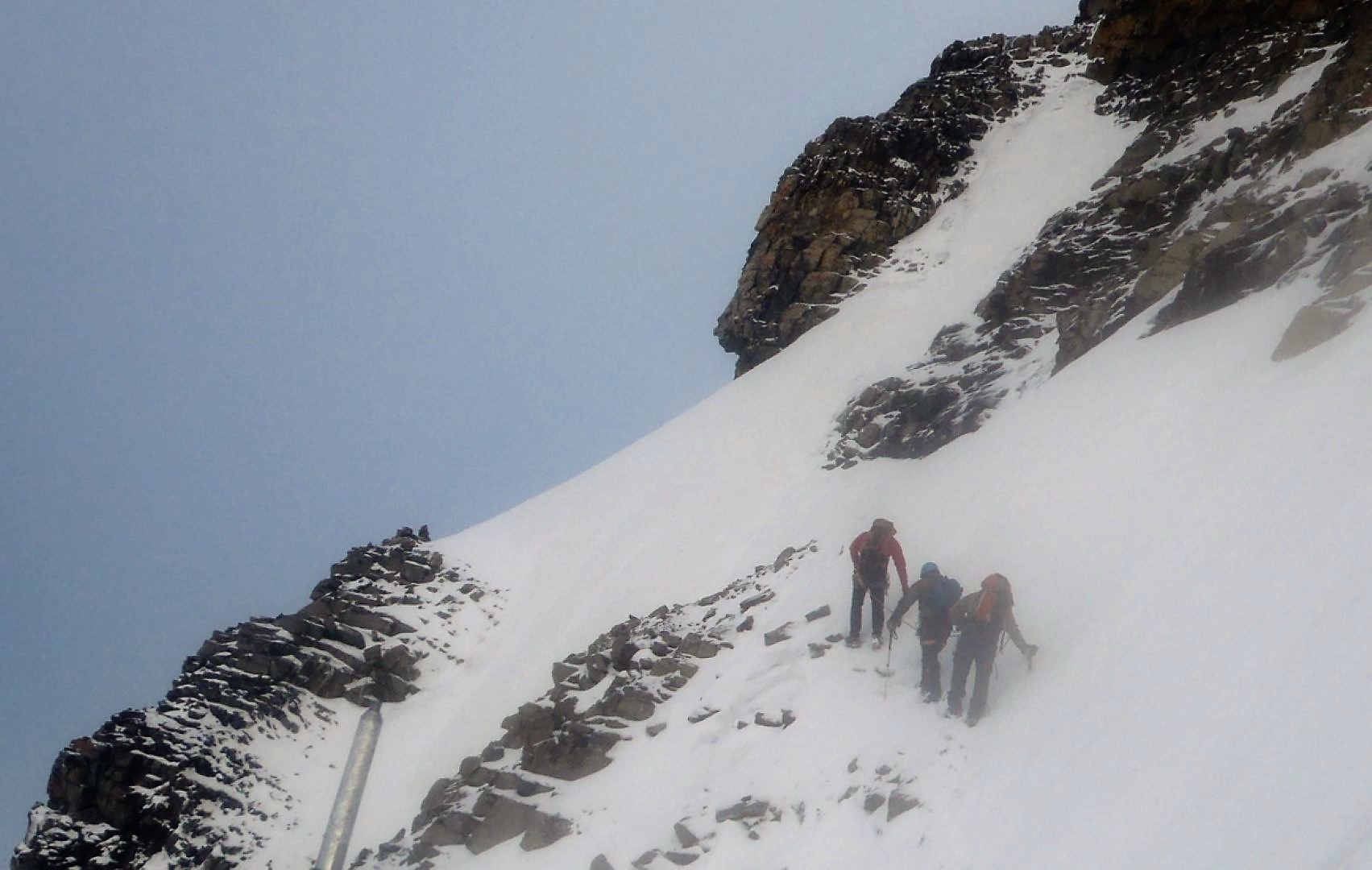
2:30am we were up and at em, leaving camp at 3:45 (still soaked) we were soon on the snow which started right at our camp. Still soaked we gained elevation for an hour, then swung right (east) to intersect the route that is described in the book. We put on crampons and roped up here. (no longer soaked).The next stage was a delicate traverse (on snow covered ledges)to the left. Usually this portion of the climb is a scree/talus slope which people can easily walk across.
This time it was front pointing on 40+ degree slope. Very exposed to slip and potential rock fall from above. After a few hundred meters of this we began to gain elevation again.
Now above the large hanging glacier, we were at about 3100m. The day was looking good, so we had to hurry before the slopes became dangerous.
Kicking steps straight up for almost an hour we finally made the short ridge to the summit.
One of the best things about our sport is “summit time”. taking in the views, high fives, pictures and a good lunch. We had to do it all in 15 seconds. Time was a wasting.
Racing down, we made the top of the airy traverse just before the sun hit it. In only a short while we were bombarded with falling snow, ice and small stones.
Bill’s rope was only a few minutes behind and he informed us afterwards that there was very little left of our buckets that were kicked in the now soft snow. Lots of big sluffs.
Good thing that Bill can still move like a 20 yr old when he has to.
After the traverse we were able to relax and enjoy the sun. Soon harness, ropes and crampons were put away and an easy boot ski to the tent was next.
The hike out was non eventfull, as the weather was now excellent. The only thing to report is the potential hazzard our trip was able to avoid, Killer Marmots. Very big, very brave and hopefully with very little memory capacity.
This is an excelent trip, but lots of research is encouraged. Please refer to Bill’s website for more info or better yet get one of us out for coffee. The approach is very complicated but the SW bivy is the best way to get up this thing fast. 9 hrs tent to tent.
Thanks for the adventure boyz.
Pictures at King George
Ben’s website